Getting to the South Pole!
Today I finally arrived at the South Pole, 90 degrees south latitude, the bottom of the world! It has been a very long journey and a long time has passed since I first left home.
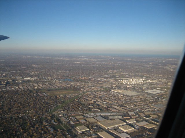
My trip began on Thursday November 10th in Chicago, Illinois at the University of Chicago. I left Chicago at 3:00 pm on that day from O’Hare Airport (ORD). My first flight brought me to the Los Angeles International Airport (LAX) in Los Angeles, California and lasted about 4.5 hours. The actual time I reached Los Angeles though was 5:30 pm. This is because there is a 2-hour difference between the time in Chicago and the time in Los Angeles. Like my last entry explained, this is because the sun rises in Los Angeles 2 hours after it does in Chicago.
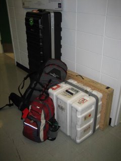
So, I packed up a ton of stuff ...
Good Bye Chicago!!!
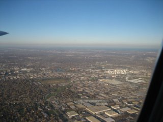
We flew over the Rocky Mountains and Las Vegas. I got a few great photos of the Rockies from the plane window. Here is a sample!
I left Los Angeles at 8:30 that night aboard a flight bound for Auckland Airport (AKL) in Auckland, New Zealand. New Zealand (NZ) is a small country, about as big as an average American state. NZ is actually two islands, a smaller northern one and a larger southern one. The country is located close to the country Australia, in the southern hemisphere, west of South America in the Pacific Ocean. The reason I was traveling to NZ was because it is one of the closest countries to Antarctica. The flight to Auckland was approximately 12.5 hours. This time though, when I arrived in Auckland, not only was the time different, but it was actually a day later!
Of course I hadn’t traveled into the future, the only reason it’s a day later is because the time difference is so great! Basically, New Zealand’s day starts 19 hours before Chicago, so when its 9 am in Chicago on say Monday, its 4 am in NZ on a Tuesday. There is actually a longitude at which this change of day is recorded and this longitude is called the International Date Line. It’s located in the Pacific Ocean just east of NZ. So when I left Los Angeles it was 8:30 pm on a Thursday, 12.5 hours of flying would make it 9 am on Friday, but because of the Date Line, it was actually 6 am on Saturday, crazy huh? Believe me, this stuff gets so hard for your body to keep track of after a while!
My final flight was at 8:30 am from Auckland, NZ to a small city in the south of the country called Christchurch, NZ. The flight there was short, only 1.5 hours and I finally reached there at 9:50 am. After the big change at Auckland, there were no more time zone changes. So I had left at 3 pm on Thursday from Chicago, and arrived at 9:50 am on Saturday in Christchurch, NZ. Since the time difference between NZ and Chicago is 19 hours, this was about 2:50 pm in Chicago. I had been traveling for almost 24 hours and there was this change of day too! Still, I wasn’t even on Antarctica yet, forgetting even the Pole.
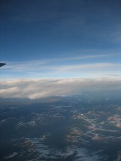
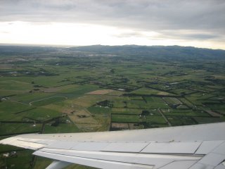
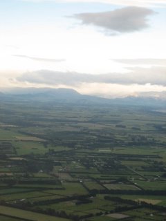
Views of Southern NZ from my flight to Christchurch.
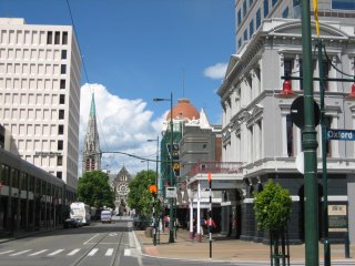
Here are some selected pics of Christchurch. A view down Worcester Blvd. with Christchurch Cathedral visible in the background...
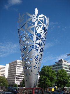
A sculpture located in Cathedral Square right outside my hotel. It was erected to celebrate Y2K.
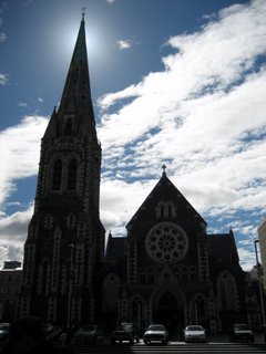
Another view of the Christchurch Cathedral …
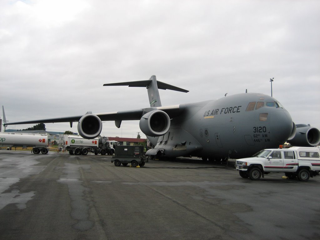
I spent 2 nights in NZ before I boarded my first flight to Antarctica, so I finally left NZ on Monday the 14th at 6:30 am. The flight to Antarctica is a very special on because unlike my other flights that had been with commercial (public) airlines, there are no companies that fly to Antarctica. The only planes that do fly there belong the Air Forces of the different nations that work on the continent. So my flight to Antarctica was on a special United States Air Force C-17 Cargo Jet. The plane was super huge and inside it there were no rows of seats, only a big open space lined with tons of tubes and pipes and equipment on the walls and filled completely with all sorts of cargo bound for scientific research and construction. The passengers had to sit on little seats that were up against the inside walls of the plane. I was lucky to sit next to a really nice air force pilot who told me all sort of interesting info about the plane. For instance, it was designed to carry one of the biggest U.S. tanks, the Abrams Tank on board!
This is the USAF C-17 cargo jet we flew on to Antarctica, its massive.

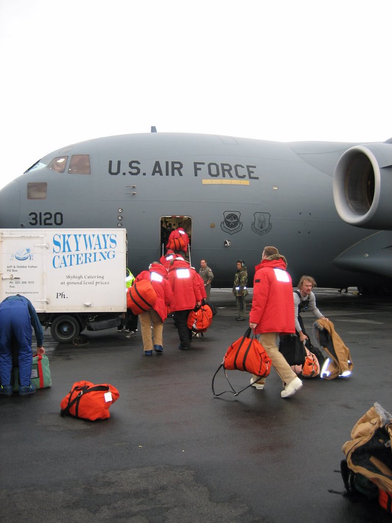
We all climbed on board, but first we were handed bagged lunches by the catering truck to the left. It was awesome, all sorts of sandwiches and goodies. The folks down here are awesome.

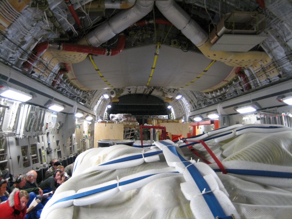
Once inside, we piled up against the walls. Check out the cargo and the bare bones look of the plane.

This is another view of the inside, this time from the front of the plane looking back.

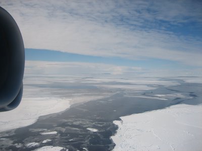
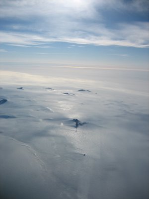
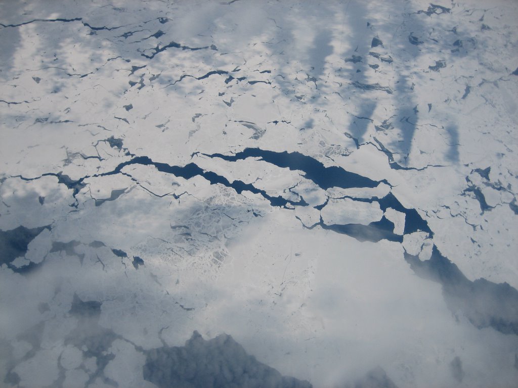
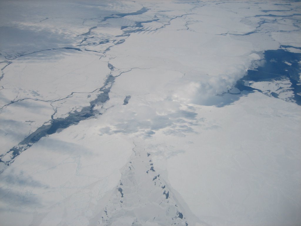
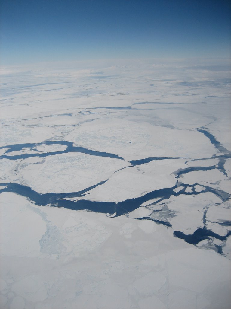
As we approached Antarctica, the first feature we could really see was the Ice Sheet. At this time of year, as summer approaches the southern hemisphere, many of the ice sheets beginning to break up and melt. This is the time that naval icebreakers begin to move their way into the continents seas and bays, slowly. In particular, we are crossing the larges of such sheets surrounding Antarctica, the Ross Ice Shelf. McMurdo is located on Ross Island, set inside this sheet.

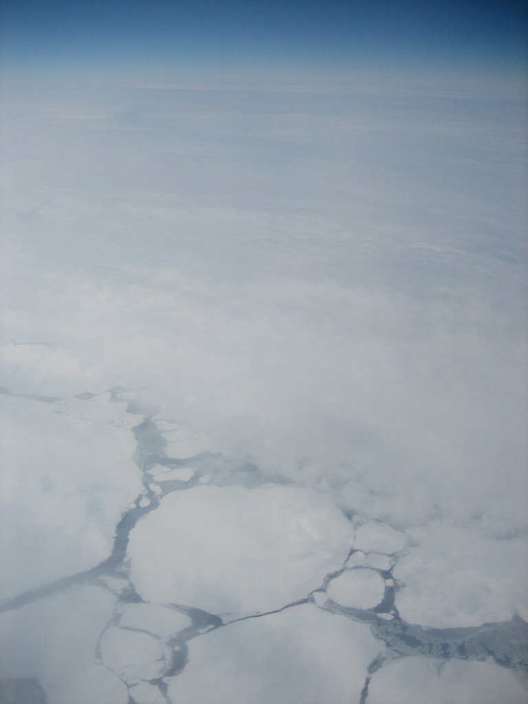
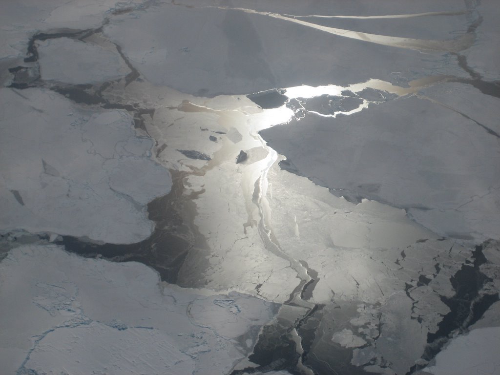
So here are a bunch of pictures of the ice breaking up below us. Some of them are super cool, when I was able to catch the reflection of the sun in particular.
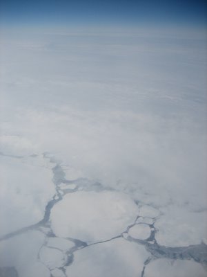


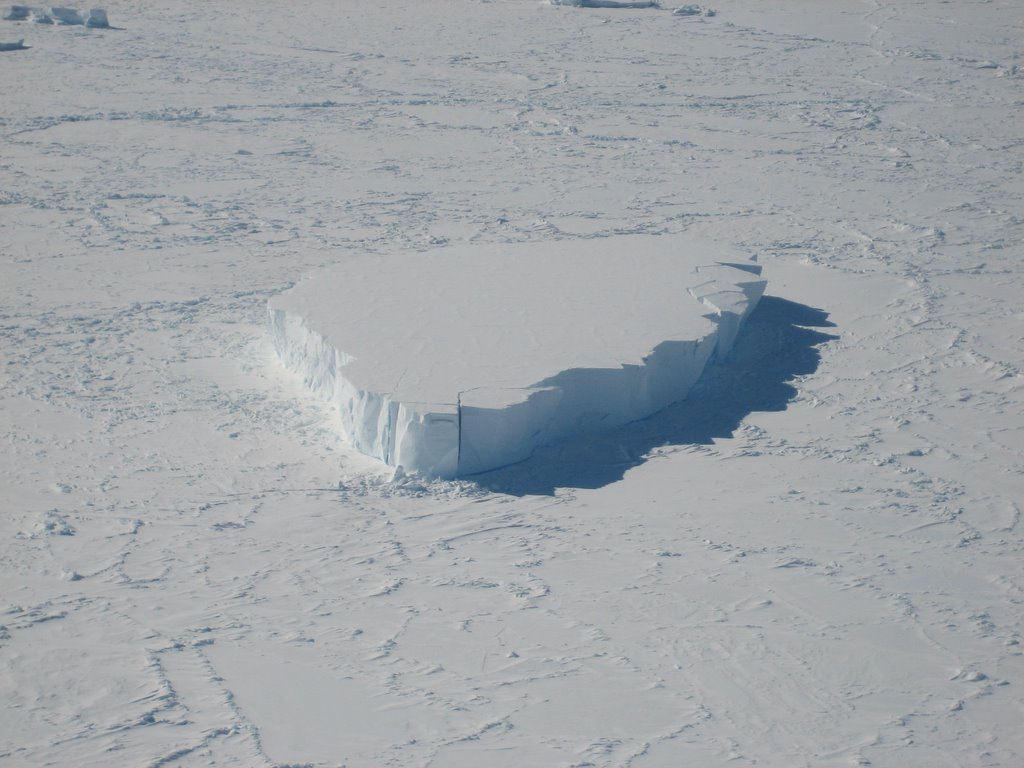
It’s an iceberg, man that was probably the coolest thing I saw.

The shadow of the plane is visible on the ice as we fly over!

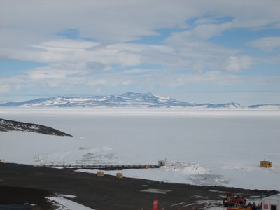
The destination of my flight to Antarctica was McMurdo. McMurdo is a small town located on Ross Island in the Ross Sea on the coast of Antarctica. Its home to many researchers and scientists as well as all the important people who make it possible to live there. People like plumbers, automobile mechanics, cooks and construction workers to name a few. The exact spot where McMurdo sits is a pretty mountainous region of the coast, so the only way to get there was for the plane to land on a special ice runway on the ice that covers the Ross Sea for most of the year. This ice is actually part of a very important system called the Ross Ice Sheet.
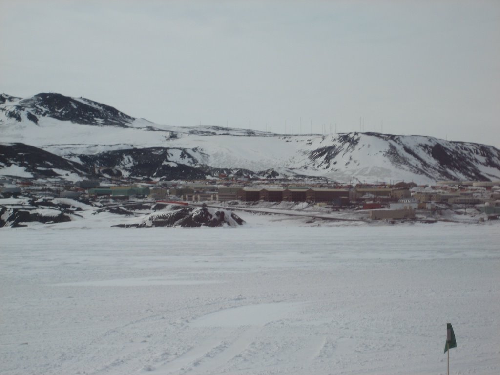
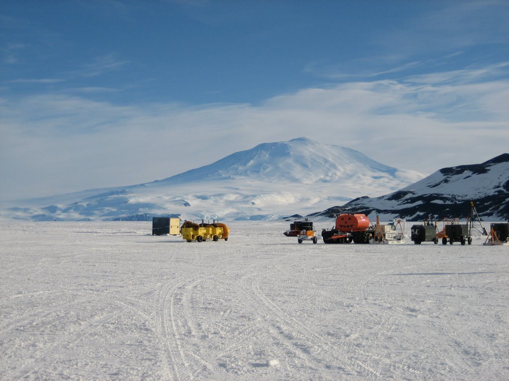
This is a view of McMurdo from the runway. As you may be able to see, its a sizable operation and looks like some kind of strip mine facility or logging camp.

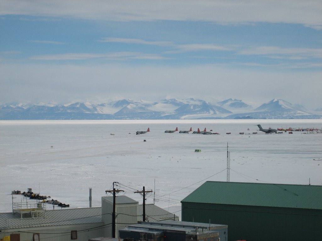
This is a typical view from McMurdo, looking out over the Ross Sea Ice Shelf. The Ice Shelf never completely melts, the point at which the melting stops is right about where McMurdo is, in the McMurdo Sound.
This is a view of the Ice runway where we landed.

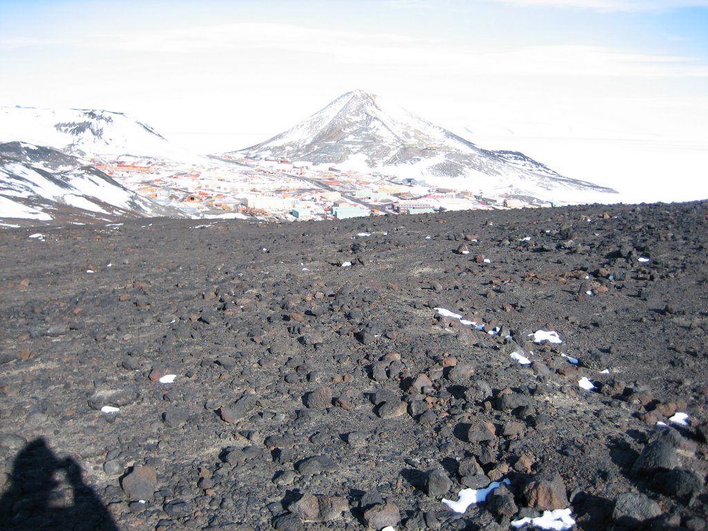
After a short hike, from near the peak of the surrounding ridge, I looked back and saw McMurdo in the distance. This is also a good close view of the terrain. As you can see, lava rocks litter the landscape. It’s a view that so closely resembles pictures sent back from Mars.

Finally, today, Tuesday the 15th at 8:30 I left McMurdo aboard another special U.S. Air Force aircraft and arrived at the Amundsun-Scott South Pole Station at about 11:30 am. This time we took a different plane, a LC-130 “Hercules” cargo plane. This aircraft is not a jet like the C-17, instead it’s a prop plane, which means it uses propellers to fly. So, Tuesday 11:30 am at the South Pole is really Monday 4:30 in Chicago! It took me exactly 4 days to get to the South Pole from home.
We came back to the runway around 8am, this time I had a bit more opportunity to snap some photos. This one is a great shot of the local active volcano, Mt. Erebus.

We boarded our flight, a LC-130 "Hercules" cargo prop plane.
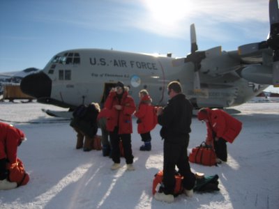
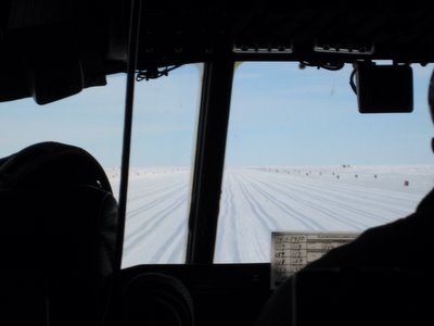
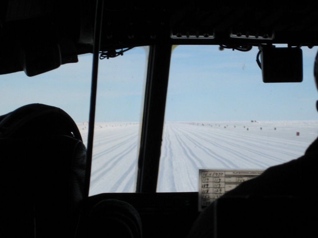
I spent a little too much time with my camera and was the last to board. It turned out they were a little short on seating so me and a colleague working on a separate CMB telescope project got bumped up to the flight deck. From there we had a great view of everything the pilots got to see, including the runway as we took off and landed.
The views from 2000 or more feet above the Ice were nothing short of spectacular, here is a shot of the ice throwing some sun back at me ...
Looking out the side window, you could see the propellers of the plane in action, it was an amazing thing to watch.

This ridge was very interesting for a number of reasons; I believe it might have run along the coast. If you look closely, you can see more "ice waves" as the ice either moved along or into the coast. Also along almost the entire length of the ridge there is a series of clouds, bilious. Lastly, there are a few clouds that cover the higher peaks of the ridge, they seem to be caused by wind blowing over the ridge. These clouds were really cool cause the reflected the sun’s light back in really cool colors, reds blues and greens although this is hard to capture.

This is another view out the side of the plane, catching the propeller in the foreground. The propeller fins are actually not visible during the flight, but the camera can capture them in a particular instant during their revolution.

If you look carefully between the two mountains in the foreground, you should be able to see what looks like the mouth of an ice river flowing out between them. This was the first major glacier I caught a shot of.

Here is a beautiful shot of mountain peaks and the gigantic snow drifts which form along them. You really get a sense for the scale of the ice and snow cover here.

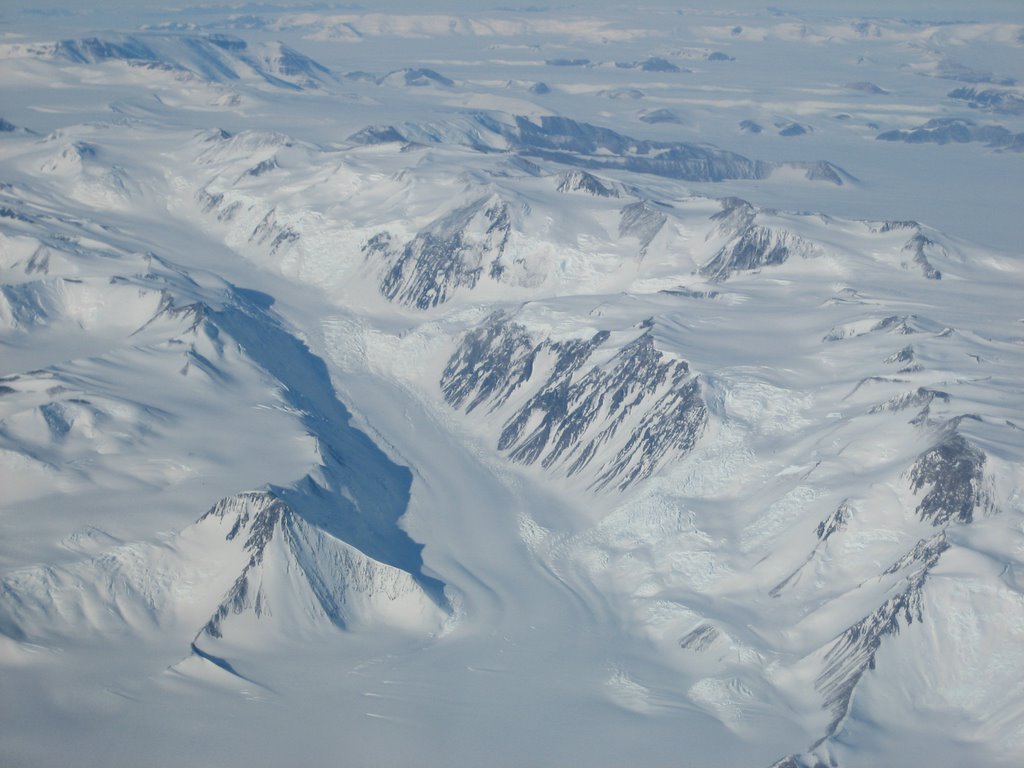
In the next picture you can very clearly see two glaciers moving around a series of mountains. There is a lot of evidence for ice flow here, and you can see where the two glaciers meet and continue together.

Well, I guess that I still have it much better than the first explorers who came to the South Pole, like Amundsen (who was first to reach the South Pole) and Robert Falcon Scott (who was second, and whose crew perished before they could return). Their voyages took months, and that’s just from New Zealand! They had to travel by boat from NZ just to reach Antarctica and then by pony and sled dog to reach the South Pole. Having felt the temperatures here, I cannot imagine walking outside for weeks to get from the coast to the Pole!
Well, that’s enough for now. In the next few posts Ill tell you more about life at McMurdo and the South Pole, temperatures, clothing and gear, some of the science here and more!
My trip began on Thursday November 10th in Chicago, Illinois at the University of Chicago. I left Chicago at 3:00 pm on that day from O’Hare Airport (ORD). My first flight brought me to the Los Angeles International Airport (LAX) in Los Angeles, California and lasted about 4.5 hours. The actual time I reached Los Angeles though was 5:30 pm. This is because there is a 2-hour difference between the time in Chicago and the time in Los Angeles. Like my last entry explained, this is because the sun rises in Los Angeles 2 hours after it does in Chicago.
So, I packed up a ton of stuff ...

Good Bye Chicago!!!
We flew over the Rocky Mountains and Las Vegas. I got a few great photos of the Rockies from the plane window. Here is a sample!

I left Los Angeles at 8:30 that night aboard a flight bound for Auckland Airport (AKL) in Auckland, New Zealand. New Zealand (NZ) is a small country, about as big as an average American state. NZ is actually two islands, a smaller northern one and a larger southern one. The country is located close to the country Australia, in the southern hemisphere, west of South America in the Pacific Ocean. The reason I was traveling to NZ was because it is one of the closest countries to Antarctica. The flight to Auckland was approximately 12.5 hours. This time though, when I arrived in Auckland, not only was the time different, but it was actually a day later!
Of course I hadn’t traveled into the future, the only reason it’s a day later is because the time difference is so great! Basically, New Zealand’s day starts 19 hours before Chicago, so when its 9 am in Chicago on say Monday, its 4 am in NZ on a Tuesday. There is actually a longitude at which this change of day is recorded and this longitude is called the International Date Line. It’s located in the Pacific Ocean just east of NZ. So when I left Los Angeles it was 8:30 pm on a Thursday, 12.5 hours of flying would make it 9 am on Friday, but because of the Date Line, it was actually 6 am on Saturday, crazy huh? Believe me, this stuff gets so hard for your body to keep track of after a while!
My final flight was at 8:30 am from Auckland, NZ to a small city in the south of the country called Christchurch, NZ. The flight there was short, only 1.5 hours and I finally reached there at 9:50 am. After the big change at Auckland, there were no more time zone changes. So I had left at 3 pm on Thursday from Chicago, and arrived at 9:50 am on Saturday in Christchurch, NZ. Since the time difference between NZ and Chicago is 19 hours, this was about 2:50 pm in Chicago. I had been traveling for almost 24 hours and there was this change of day too! Still, I wasn’t even on Antarctica yet, forgetting even the Pole.
Views of Southern NZ from my flight to Christchurch.


Here are some selected pics of Christchurch. A view down Worcester Blvd. with Christchurch Cathedral visible in the background...

A sculpture located in Cathedral Square right outside my hotel. It was erected to celebrate Y2K.

Another view of the Christchurch Cathedral …

I spent 2 nights in NZ before I boarded my first flight to Antarctica, so I finally left NZ on Monday the 14th at 6:30 am. The flight to Antarctica is a very special on because unlike my other flights that had been with commercial (public) airlines, there are no companies that fly to Antarctica. The only planes that do fly there belong the Air Forces of the different nations that work on the continent. So my flight to Antarctica was on a special United States Air Force C-17 Cargo Jet. The plane was super huge and inside it there were no rows of seats, only a big open space lined with tons of tubes and pipes and equipment on the walls and filled completely with all sorts of cargo bound for scientific research and construction. The passengers had to sit on little seats that were up against the inside walls of the plane. I was lucky to sit next to a really nice air force pilot who told me all sort of interesting info about the plane. For instance, it was designed to carry one of the biggest U.S. tanks, the Abrams Tank on board!
This is the USAF C-17 cargo jet we flew on to Antarctica, its massive.
We all climbed on board, but first we were handed bagged lunches by the catering truck to the left. It was awesome, all sorts of sandwiches and goodies. The folks down here are awesome.
Once inside, we piled up against the walls. Check out the cargo and the bare bones look of the plane.

This is another view of the inside, this time from the front of the plane looking back.
As we approached Antarctica, the first feature we could really see was the Ice Sheet. At this time of year, as summer approaches the southern hemisphere, many of the ice sheets beginning to break up and melt. This is the time that naval icebreakers begin to move their way into the continents seas and bays, slowly. In particular, we are crossing the larges of such sheets surrounding Antarctica, the Ross Ice Shelf. McMurdo is located on Ross Island, set inside this sheet.
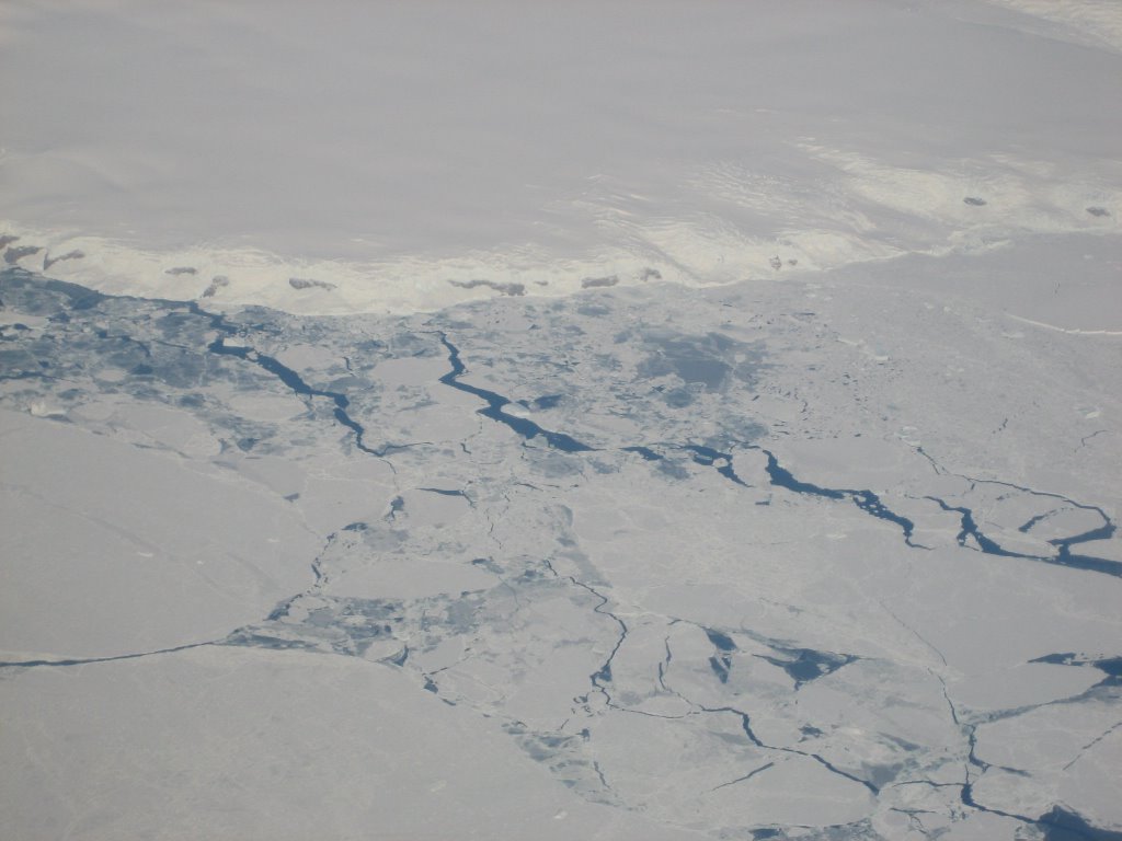
So here are a bunch of pictures of the ice breaking up below us. Some of them are super cool, when I was able to catch the reflection of the sun in particular.


It’s an iceberg, man that was probably the coolest thing I saw.
The shadow of the plane is visible on the ice as we fly over!

The destination of my flight to Antarctica was McMurdo. McMurdo is a small town located on Ross Island in the Ross Sea on the coast of Antarctica. Its home to many researchers and scientists as well as all the important people who make it possible to live there. People like plumbers, automobile mechanics, cooks and construction workers to name a few. The exact spot where McMurdo sits is a pretty mountainous region of the coast, so the only way to get there was for the plane to land on a special ice runway on the ice that covers the Ross Sea for most of the year. This ice is actually part of a very important system called the Ross Ice Sheet.
This is a view of McMurdo from the runway. As you may be able to see, its a sizable operation and looks like some kind of strip mine facility or logging camp.
This is a typical view from McMurdo, looking out over the Ross Sea Ice Shelf. The Ice Shelf never completely melts, the point at which the melting stops is right about where McMurdo is, in the McMurdo Sound.

This is a view of the Ice runway where we landed.
After a short hike, from near the peak of the surrounding ridge, I looked back and saw McMurdo in the distance. This is also a good close view of the terrain. As you can see, lava rocks litter the landscape. It’s a view that so closely resembles pictures sent back from Mars.
Finally, today, Tuesday the 15th at 8:30 I left McMurdo aboard another special U.S. Air Force aircraft and arrived at the Amundsun-Scott South Pole Station at about 11:30 am. This time we took a different plane, a LC-130 “Hercules” cargo plane. This aircraft is not a jet like the C-17, instead it’s a prop plane, which means it uses propellers to fly. So, Tuesday 11:30 am at the South Pole is really Monday 4:30 in Chicago! It took me exactly 4 days to get to the South Pole from home.
We came back to the runway around 8am, this time I had a bit more opportunity to snap some photos. This one is a great shot of the local active volcano, Mt. Erebus.
We boarded our flight, a LC-130 "Hercules" cargo prop plane.

I spent a little too much time with my camera and was the last to board. It turned out they were a little short on seating so me and a colleague working on a separate CMB telescope project got bumped up to the flight deck. From there we had a great view of everything the pilots got to see, including the runway as we took off and landed.
The views from 2000 or more feet above the Ice were nothing short of spectacular, here is a shot of the ice throwing some sun back at me ...

Looking out the side window, you could see the propellers of the plane in action, it was an amazing thing to watch.

This ridge was very interesting for a number of reasons; I believe it might have run along the coast. If you look closely, you can see more "ice waves" as the ice either moved along or into the coast. Also along almost the entire length of the ridge there is a series of clouds, bilious. Lastly, there are a few clouds that cover the higher peaks of the ridge, they seem to be caused by wind blowing over the ridge. These clouds were really cool cause the reflected the sun’s light back in really cool colors, reds blues and greens although this is hard to capture.

This is another view out the side of the plane, catching the propeller in the foreground. The propeller fins are actually not visible during the flight, but the camera can capture them in a particular instant during their revolution.

If you look carefully between the two mountains in the foreground, you should be able to see what looks like the mouth of an ice river flowing out between them. This was the first major glacier I caught a shot of.
Here is a beautiful shot of mountain peaks and the gigantic snow drifts which form along them. You really get a sense for the scale of the ice and snow cover here.

In the next picture you can very clearly see two glaciers moving around a series of mountains. There is a lot of evidence for ice flow here, and you can see where the two glaciers meet and continue together.

Well, I guess that I still have it much better than the first explorers who came to the South Pole, like Amundsen (who was first to reach the South Pole) and Robert Falcon Scott (who was second, and whose crew perished before they could return). Their voyages took months, and that’s just from New Zealand! They had to travel by boat from NZ just to reach Antarctica and then by pony and sled dog to reach the South Pole. Having felt the temperatures here, I cannot imagine walking outside for weeks to get from the coast to the Pole!
Well, that’s enough for now. In the next few posts Ill tell you more about life at McMurdo and the South Pole, temperatures, clothing and gear, some of the science here and more!
posted by Robert B. Friedman at 4:45 AM
![]()
![]()


5 Comments:
Sounds fascinating! I'd love to see some photographs if you can arrange this. Looking forward to hearing more about your stay there.
I love your blog. Its great! Very interesting! Any updates since 2005? Are you back in the states, in Antartica or any trips since that one?!
how you survive in dark for months. how do you maintain your health.
is there way a tourist can reach there?
From NZ you flew via USAF cargo jet C17 then USAF Hercules?? How does a civilian fly with the govt? Is it costly? Is there advance paperwork that needs to be done prior to??
Great blog and photos. Sounds like it was an interesting time.
Post a Comment
<< Home